About Us.

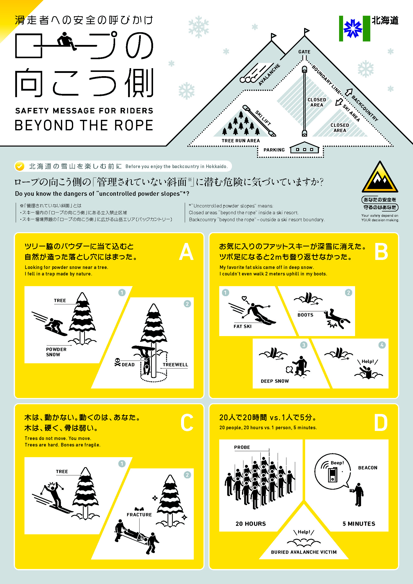
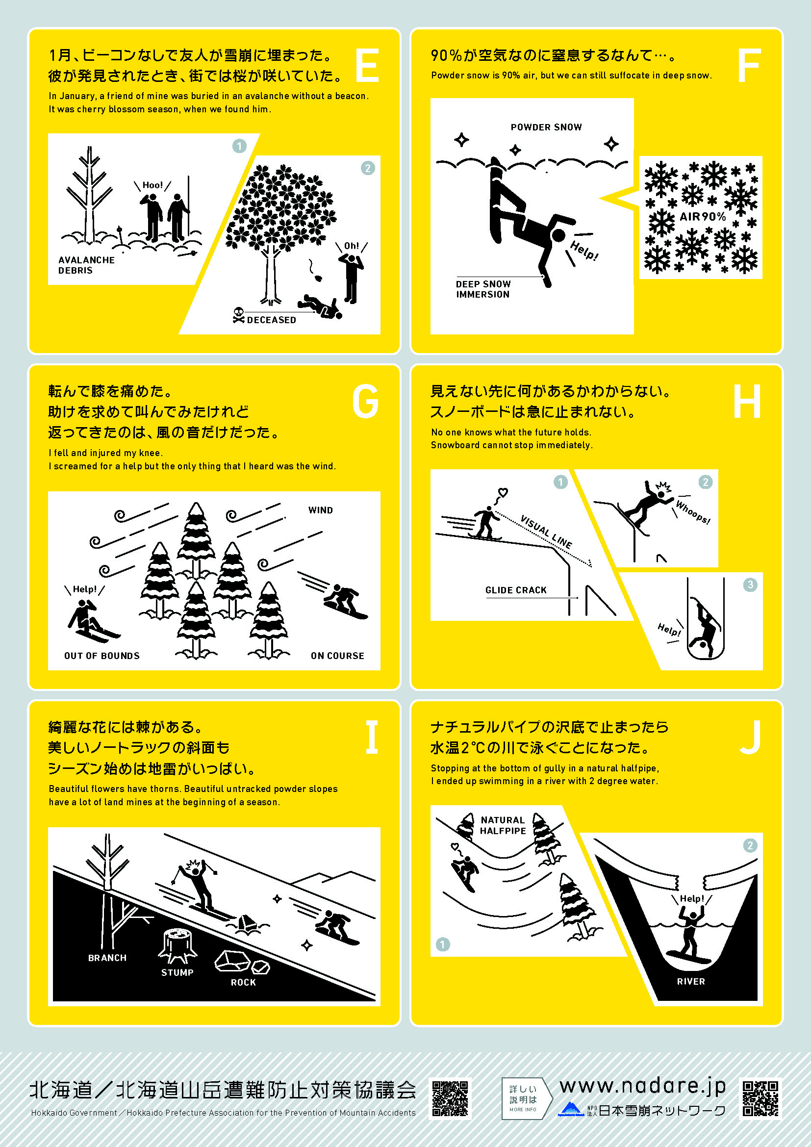
Backcountry skiing and snowboarding in Hokkaido offers an amazing off-piste experience. Unlike resort piste-skiing, the powder snow and sense of freedom in the Hokkaido backcountry is unmatched. However, this activity comes with many inherent risks, such as avalanches, getting lost, falling, slipping, and cold temperatures.
A total of 190 search and rescue cases were reported in Hokkaido in the five seasons from 2014 to 2018, with the causes being getting lost (approximately 50%), colliding with trees (approximately 20%), falling (approximately 15%), and avalanches (approximately 5%). In the five seasons from 2020 to 2024, a total of 11 people died in avalanches.
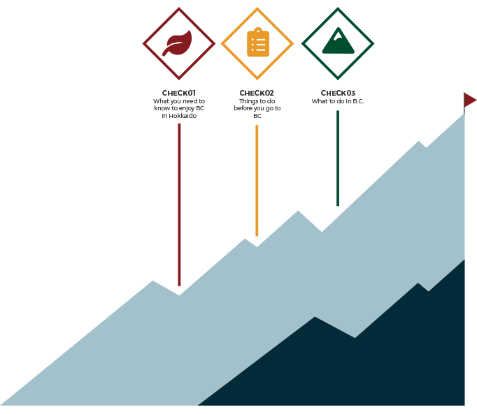
Before heading into the Hokkaido backcountry, take the time to review our Three Tips to enjoy the Hokkaido backcountry safely.
WEB CAMERA
Web cameras have been installed at several popular backcountry trailheads in Hokkaido.
You can check the local conditions from January to February, and you can also look back at past footage, so you can check the wind and snow conditions from several days ago to check the weather and snow conditions, etc., and use this information to help you judge the risks.
You can check the local conditions from January to February, and you can also look back at past footage, so you can check the wind and snow conditions from several days ago to check the weather and snow conditions, etc., and use this information to help you judge the risks.
Mount Yotei, Kyogoku

Mount Yotei, Makkari

Niseko Goshiki Onsen

Characteristics of Typical Backcountry Areas in Hokkaido
Niseko Area map❶
The Niseko Range is close to the coast, so it receives snowfall almost every day during the season. Mt. Annupuri is accessible by lifts and welcomes many skiers, and there are many routes in the surrounding mountains. In the ski area of Mt. Annupuri, the area where you can enter the backcountry area is controlled by gates. Please read the Niseko Avalanche Information carefully and follow the instructions of the patrol when deciding whether to use the backcountry area.
Goshiki Onsen, west of Niseko Annupuri, is a popular trailhead for the Niseko backcountry. There is a snowplowed parking lot in the area – make sure to use this rather than park on the road, as this gets in the way of snow-clearing work. Also, the parking lot at Goshiki Onsen is a space reserved for hot spring guests, so please do not park there. Parking space is also limited at the trailhead to Nitonupuri, so please be considerate not to get in the way of snow removal or traffic.
Mt. Yotei is accessible from all directions and is the mountain visited by the most backcountry skiers in Hokkaido, but there are many avalanche terrains such as streams, and avalanche accidents occur frequently. Parking space is also limited on Mt. Yotei. It is also necessary to reduce the number of cars parked at the end of the road or on the side of the road by carpooling or using taxis so as not to interfere with the lives of local residents.
In the 2024-2025 season, webcams have been installed at the Goshiki Onsen trailhead and the Makkari trailhead of Mt. Yotei. Please use them to check the weather and snow conditions before entering the mountains.
See the webcams here >>>
Yoichi Area map❷
This area is also close to the coast and receives a lot of snowfall. Kiroro Ski Resort is located on the west side of Mt. Asari. From Kiroro Ski Resort, there are many options, such as the 1107m peak and Mt. Yoichi. The terrain , however, is complex and there are many streams, so it can be difficult to cross the streams early in the season. Careful route planning is required. If you are accessing the backcountry area from Kiroro Ski Resort, please use the gate at the top of the ski area. Some people park their cars in the parking lot of Kiroro Ski Resort and use the forest road to enter the backcountry, but this parking lot is for Kiroro Ski Resort users, so please do not cause any trouble to the ski resort.
A webcam will be installed at the top of the Kiroro gondola in the 2024-2025 season. Please use it to check the weather and snow conditions.
See the webcams here >>>
Furano Ski Area map❸
Furano ski resort boasts high quality “Bonchi Powder” (literally “Basin Powder”). The Kitanomine Gondola and ropeway ski lift provide access to great skiing.
When accessing the backcountry, please exit through the gates at the top of each slope. The slopes note that on the west side of the ridge, opposite the ski resort, may look attractive, but it is difficult to return to the slopes once you have descended. Once you reach the bottom of the slope, you will find yourself in a difficult situation, as there are long forest roads that have not been plowed and mobile phones do not work. In some places, there are many steep slopes and small streams, so there are many accidents due to slipping and falling, so please be careful.
Furano-dake/Tokachi-dake Area map❹❺
Mt. Furano is a popular backcountry destination due to the cold temperatures, quality snow, and large slopes. If you descend too far on the way back, it will be difficult to return to the trailhead, so be sure to navigate carefully. There is a parking space at the junction of roads heading to Tokachidake Onsen and Fukiage Onsen (here>>>) , but the space is limited. Overflow parking obstructs traffic and snow-clearing operations, so be open to changing plans if parking space is not available.
There is a large parking space in front of Hakuginso, but it is for hot spring users. Climbers should use the space on the north side, away from Hakuginso (see this image >>>) . After descending the mountain, enjoy the large open-air bath and sauna at Shiroganeso. You can choose to go to Sandanyama if visibility is poor, or to Tokachidake if the weather is good. The route up Tokachi-dake very soon goes beyond the tree-line. Exercise extreme caution when visibility is poor. Snow is often thin, so beware of rocks and fall hazards while skiing. Webcams have been installed at both trailheads in the 2024-25 season. Please use them to the weather, and the snow conditions.
See the webcams here >>>
Asahidake Area map❻
The Asahidake area(Google Maps >>>) is very popular for its tree runs and good snow quality, and recently the wait time for the ropeway often exceeds 1 hour. Many of the surrounding slopes are steep, and there have been accidents such as avalanches, slips and falls, and falls from cornices when visibility is poor. The upper part of the mountain is above the tree line, the wind is often strong, and the temperature can drop below -20 degrees. This is an area where frostbite and hypothermia are common. Be sure to prepare for the cold. There are no ski patrols at the Asahidake Ropeway. If you go off the course, you will need to deal with all accidents yourself. Please enjoy powder skiing with members who have avalanche rescue equipment, knowledge, first aid, and can transport others. In case of an emergency, rescue kits and transport sleds are available at the ropeway, so please contact the ropeway staff.
A webcam has been installed at the ropeway summit station in the 2024-2025 season. Please use it to check the weather and snow conditions.
See the webcams here >>>
Kurodake Area map❼
Kurodake boasts the highest ski resort in Hokkaido. High-quality powder snow accumulates on the eastern slopes, which are protected from the northwest winds. The summit of Mt. Kurodake can be reached in about 2-3 hours from the top of the lift. There are backcountry routes beyond the peak, but the volcanic terrain is very steep in places. Waterfalls are frequent, often requiring climbing equipment to navigate. Overall, route is finding very difficult in the area beyond the main eastern face. Unfortunately, the ropeway will be closed from January 4th to March 7th for the 2024-25 season due to inspection work. Since it takes an extra 4-5 hours to climb to the top of the slope, if you are going to enter the mountain, you will need to leave early and plan your time accordingly, taking into account sunset.
Horokanai Area map❽
Located on the west side of Asahikawa, the Horokanai area is blessed with the most snowfall in Hokkaido due to its closeness to the coast and low temperatures. There are many low-altitude peaks and backcountry routes in the area. You can enjoy tree runs and abundant snow, but there are no public parking lots. You will have to park in parts of the snowplow turning areas, but please park in a way that does not obstruct the passage of snowplows.
Rishiri Area map❾
Mount Rishiri, a volcano located in the northernmost part of Hokkaido, is a free-standing peak at about 1,700 meters above sea level. This mountain floating on the sea has some of the harshest weather conditions in Hokkaido, with the tree line at around 1,000 meters above sea level. There are no maintained parking lots, so please be considerate of snowplows and local residents when parking. In the high season of January and February, bad weather often causes flights and ferries to be canceled. We recommend that you plan your visit with plenty of time in mind.
WEATHER INFO
AVALANCHE INFO
USEFUL INFO
SUBMIT A BACKCOUNTRY PLAN
Creating and submitting a mountain climbing plan is the first step in preventing accidents. Make a plan that is appropriate for your and your companions’ physical strength and skills. Submit the plan to the police station as well as to your family and workplace.

SUBMIT A CLIMBING PLAN

Creating and submitting a mountain climbing plan is the first step in preventing accidents. Make a plan that is appropriate for your and your companions’ physical strength and skills. Submit the plan to the police station as well as to your family and workplace.
